North Texas is in an Exceptional drought as I type this update, which means that we are in the most significant form of drought on the drought monitor.... however, if the GFS verifies we could get some rain, while this wouldn't be a drought denting rain, it would help along the process.
Seen here is the GFS precipitation forecast on Friday Morning at 6 A.M, the GFS presently forecasts numerous to widespread showers and thunderstorm to be in place across North Texas. Severe weather would be unlikely given the widespread nature of the rain. Temperatures would also be much cooler, with high's possibly falling into the 70's across rainy areas.
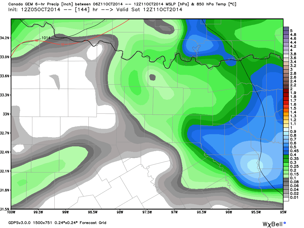
Meanwhile... the CMC shows the rain coming in at a later time:
If you believe the CMC the entire area will see very heavy rain at some point Friday Night - Sunday, it's a key amount of difference that makes the difference between a nice weekend and a depressing one ( depending on who you are).
The EURO also shows heavy rain across North Texas on Saturday... which means it is closer to the CMC than the GFS, rainfall could range from 1-3 inches... which means it will help get rid of but not majorly dent the drought.


No comments:
Post a Comment